Wednesday 3 April 2013

Painted Desert and Petrified Forest are Awesome

28 Mar 2013


THIS A PANORAMA - PLEASE USE YOUR BOTTOM SCROLL BAR (GO RIGHT) TO SEE THE WHOLE PICTURE. YOU CAN ALSO CHANGE THE "VIEW" TO LESS THAN 100% IF DESIRED
 
When you first get here it’s easy to get a little snap happy. Clickin’ away with abandon – after all it’s only electrons and memory space. That is until you decide to go through them to separate the wheat from the chaff so you can share the better ones. Never mind the part where you’re tripping over your own feet as you take in the spectacular sights, rushing to whip off another great (maybe) photo. And the first pieces of petrified wood – gotta shoot all the angles!

Didn’t realize there are fields of the stuff!

Which may explain the 360 photos of the place I waded through for this entry.

Painted desert colours…


are complimented by some interesting man made sights:

Painted Desert Inn. Preserved but no longer functional

Less preserved (the car). Human still somewhat functional

Now you know everything.

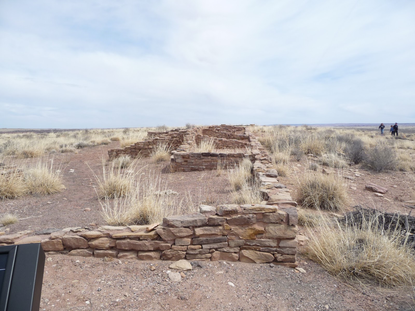
In it's better days this was a pueblo

In earlier times, perhaps when water was more readily available, the Puebloan People built in this area – leaving around 1380 A.D.

The"Rio Puerco" is now a sandy wash.

They also liked to doodle on the rocks.


I said "Ibis and frog" I was right, I was right, I was right, I was right, OW!


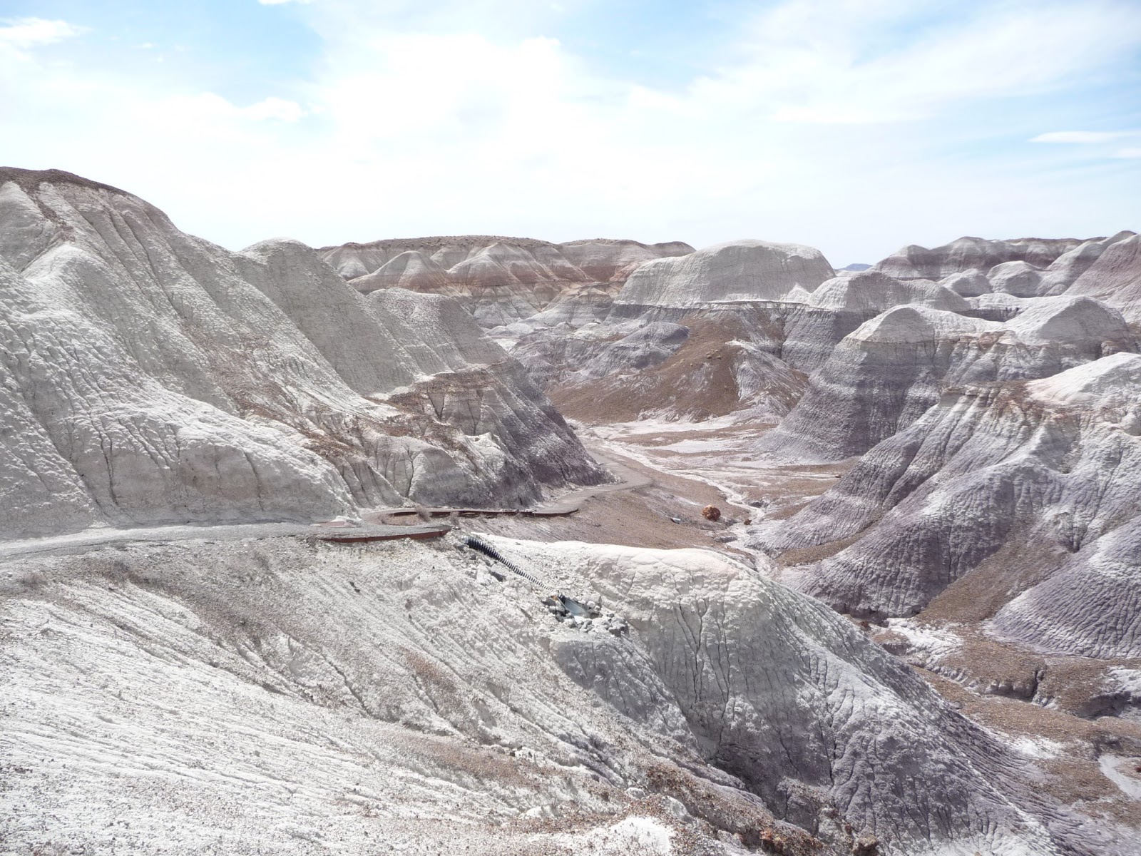
On the 28 mile trip from park entry to exit there are just two food vendors so we packed a lunch. Decided this was the perfect view (through the windshield) and parked here. Got all excited again about petrified wood until we walked down the Blue Mesa Trail. Fortunately the Blue Mesa Trail is steep enough to induce deep breathing so we calmed right down. Speechless in fact. No breath. Got over it and resumed jabbering and clicking:


It's a rock!

Funny human gasping for breathe looking cool (right?)

The striations are incredible.
Moved on to the “Agate Bridge” attraction – a very long (135’) and complete petrified log supported by concrete back in the early 1900’s. Who knew there were lots more in the Long Logs section further along?  Anyway – here it is…


Oh sure - we know all about Triassic
Don’t remember where we saw these log chunks but based on the colour and initial feel you would swear they were wood, not 200 million year old rocks. Easy to check with your foot if you like.


The logs come in a broad spectrum of colours with centres of red, brown, purple and more and exteriors that include grays, oranges, reds and browns. Many look incredibly real with bark textures and even internal rings.

These were BIG trees


Remember the excitement about the big Agate Bridge log? Check out these big boys –


The call this one "Old Faithful" Biggest in the Park
While out on the Long Log Trail we also took the Agate House Trail (this was the completer for us – we have walked all of the official trails). Agate House was a reconstruction using original petrified log chunks and displayed a quiet beauty for such a simple structure. The human included is neither quiet nor beautiful.


End of the day - heading out at 5:30 p.m.

When I say we “did” all the trails I didn’t mean - we won't come back. This place is worth another look.

And the pictures? They do not do the place justice. You have to see it to properly appreciate it.

Just put it on the Bucket List and get on with it. No – don’t click the red X yet – go write it down – it’s worth it.

No - really!


I’m watching…

Standin’ on the corner of Winslow Arizona


26 Mar 2013


For all of us who learned everything we needed to know about music in the 60’s and 70’s (or so we thought at the time and still do after a few beers) Winslow Arizona became cool in 1972 because the Eagles said so.
We knew nothing about Winslow. Still don’t but now we can say we’ve been there and that we stood in Standin’ On The Corner Park. Drove in off I40 and discovered this sign with convenient directions to nostalgialand:


On the way to Route 66 we took a few random shots that left us wondering why Glen Frey was here in the first place (he was wasn’t he?). Other than remnants of Route 66 and a few now defunct 60’s type businesses in the area we didn’t see much to write home about. However, it seems that the town has seized opportunity where it can and makes it very clear how to get to that famous corner:

Route 66. Little light on Harley Hogs and 57 Chevy's today


I truly thought we would have to scout out the "corner". Just a bit naive.

Having been born in 2004 HB didn't get the fuss. Babysat Smiley (hiding behind) on a back street.

Naturally, there were impromptu tourista pics. Nothing staged here.


Yes, if you are old enough to know how to drive this red Ford truck you should go. If nothing else you can add to your Route 66 trinket collection across the street.

 
T-shirts are nice.


Getting High in Arizona and New Mexico


26 and 29 Mar 2013

First a little confession – we did inhale. Many times on the journey from Bullhead City AZ to Santa Fe NM. Turns out that when you start at the river in Bullhead City (elev. 550 feet) everywhere is up. Seen through the windshield it’s not that obvious but it sure shows up at the gas pedal. Had to say a few comforting words to HB after beating him up a bit on these seemingly never ending hills.  

Shortly after pulling out of Bullhead City

The scenery was impressive as we climbed to Kingman (elev. 3300 feet) through Union Pass (elev. 3600 feet).


You can read the elevations but they really don’t prepare you for an almost continuous climb (and ear popping):
 
No chance of catching up to that 18 wheeler


Every downhill is a thrill now


That green sign says 5000 feet

More up

and up

and up

We finally reached the near-pinnacle of our journey, Flagstaff AZ sitting at a lofty 7000 feet. Still have snow at the roadside.

oh goody - snow

Sorry Flagstaff – can’t stay – still have a severe snow allergy.

For a while we headed down to our destinations of Winslow AZ (for pictures and t-shirts of course) and Holbrook (only 5000 feet above sea level!). Holbrook was our launch point to check out the Painted Desert and Petrified Forest). More on them in a later entry. On leaving Holbrook we were lulled by a high flat desert plain,

flat can be nice sometimes

broken only when we neared the New Mexico border:


We reach the New Mexico border

The rise in elevation wasn’t severe but we did note another high point when we reached the Continental Divide in New Mexico. At 7275 feet it became the range topper of the trip.

Continental Divide coming up

After that – lots of ups and downs on the way to our current location in Tijeras NM about 20 miles east of Albuquerque NM. Tijeras sits about 6300 feet up while Albuquerque ranges from 5000 to 6000 feet. As lowlanders from Barrie Ontario (elev. 827 feet) who have been living in lowland Texas and Arizona the effect of this climb is significant – we still go out for hikes (our campground backs on the Cibola National Forest) – uphill only of course. But now we get to wheeze like octogenarians until we get conditioned to the height and thinner air. Our solution was a trip up (yep more up) to Santa Fe (elev. 7000 feet).

Nice as it is in these mountains we do look forward to dropping down to our next destination Amarillo TX (elev. 3600 feet). Then we move on to Oklahoma City which just skims the surface at 1200 feet above the sea.